
We are happy to welcome Marina Cazorla, the Coastal Programs Manager for the California Department of Parks and Recreation in Sacramento, as the PMEP Steering Committee’s newest member! Before working for the parks department, Marina worked with the California Ocean Protection Council, the State Coastal Conservancy, and the Coastal Commission, as well as with an association of environmental philanthropies supporting coastal conservation in Mexico. She holds a B.A. from Claremont McKenna College and a Master’s degree from Harvard’s Kennedy School of Government. One of her fondest college memories is meeting novelist Haruki Murakami. She currently pursues pandemic hobbies, including failed gardening, happy chickens, and a new camper trailer.
- December 16, 2020
- Joan Drinkwin
- Uncategorized
- 0 comments
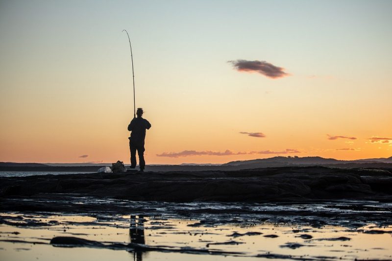
PMEP is excited to share NOAA’s Office of Habitat Conservation and the Recreational Fisheries Initiative Request for Proposals for projects within coastal Fish Habitat Partnerships that protect or restore habitat AND engage recreational fishing partners. The National Fish Habitat Partnership and individual Fish Habitat Partnerships provide strategic opportunities to advance priority habitat conservation projects while also engaging recreational anglers.
The goals of this funding opportunity are to support Fish Habitat Partnerships’ habitat restoration work and to enhance collaboration with the recreational fishing community.
As one of 20 Fish Habitat Partnerships around the nation, PMEP is happy to facilitate projects within coastal Washington, Oregon, and California to pursue this funding.
For information on how to propose a project, click here.
Photo Credit: Squirrel_photos from Pixabay.
America’s Conservation Enhancement Act signed into law with bipartisan support and unanimous consent
- November 17, 2020
- Joan Drinkwin
- Announcement
- 0 comments
The America’s Conservation Enhancement Act, was enacted into law on October 30th, 2020, and reauthorizes the North American Wetlands Conservation Act (NAWCA) and codifies the National Fish Habitat Partnership (NFHP), which represent two of the most successful voluntary conservation efforts in the United States.
The NFHP is comprised of 20 individual Fish Habitat Partnerships, each focusing on improving fish habitat and aquatic communities at regional and local levels. The NFHP has supported over 1,000 projects supporting fish habitat in all 50 states since 2006. Annually, the U.S. Fish and Wildlife Service provides funding and technical assistance to the partnerships to implement aquatic conservation projects nationwide and is also supported by many federal, state, and local agencies as well as regional and national conservation organizations.
With the signing of the bill into law, the National Fish Habitat Partnership is authorized for the next five fiscal years (2021-2025) at $7.2 million annually. The National Fish Habitat Board will report to Congress, particularly the Committee on Commerce, Science, and Transportation and the Committee on Environment and Public Works of the Senate, and the Committee on Natural Resources of the House of Representatives. The law will also expand the NFHPB to 26 members to include representatives from private landowners, agricultural production, representative involved in fish habitat restoration, corporate industries, and a member of an active FHP.
Technical and Scientific Assistance funds are authorized to be appropriated for up to $400,000 annually to each of the following agencies: National Oceanic and Atmospheric Administration (NOAA), Environmental Protection Agency (EPA), U.S. Fish and Wildlife Service, U.S. Forest Service, and U.S. Geological Survey in support of the National Fish Habitat Partnership. Within one year of enactment, the agencies receiving Technical and Scientific Assistance funds, led by the Department of the Interior, will develop an interagency operational plan outlining the implementation needs and interagency agreements.
A coalition of conservation organizations commended the sponsors of this bipartisan legislation for their commitment to fish and wildlife conservation: Sen. John Barrasso (R-WY), Sen. Thomas Carper (D-DE), Sen. John Boozman (R-AR), Sen. Benjamin Cardin (D-MD), and Sen. Martin Heinrich (D-NM) as well as Rep. Mike Thompson (D-CA), Rep. Robert Wittman (R-VA), Rep. Joe Cunningham (D-SC), Rep. Marc Veasey (D-TX), and Rep. Debbie Dingell (D-MI) in getting it to the President’s desk for signature during this Congressional session.