PMEP Issues Call for Nearshore Datasets

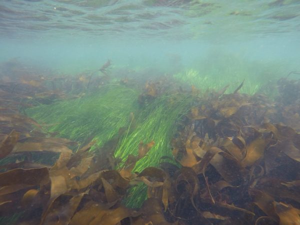
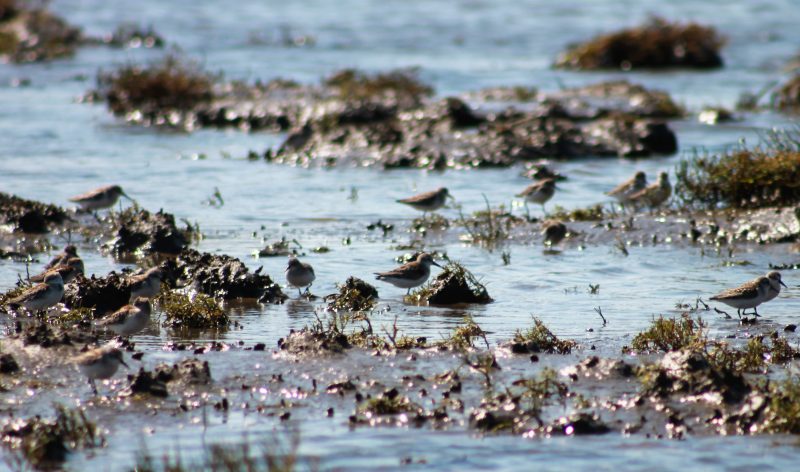
PMEP is expanding its spatial data framework to include nearshore areas and developing a ‘State of the Knowledge’ report on West Coast nearshore habitats.

PMEP is seeking spatially interpreted data (in either vector or raster format) identifying nearshore fish and invertebrate habitats (substrate, biotic, and water column component). We are placing a priority on datasets with a large spatial footprint that consistently map a habitat feature or features for large segments of the coast (preferably 10’s to 100’s of kilometers). For this project, PMEP is identifying the core nearshore as the upper end of the splash zone to -30m depth. In addition, PMEP is requesting data that extends beyond -30m to -100 (Seaward Zone) since many nearshore fish and invertebrates use habitats deeper than -30m. We are not currently looking for data from estuaries, however, we are looking for data for the nearshore of Puget Sound while recognizing that the Sound itself is classified as an estuary. For a full description of this request and a list of datasets already in hand, see PMEP_NearshoreDataCall.

If you would like to contribute to this effort, contact PMEP Data Steward, Kate Sherman, at info@pacificfishhabitat.org or 503-595-3100 by January 31, 2020.

PMEP Announces FY19 Funded Projects

The Pacific Marine & Estuarine Fish Habitat Partnership (PMEP) is pleased to announce its FY2019 funded projects. The three projects, Eelgrass Expansion in the Morro Bay Estuary, Assessment and mapping of seagrass and macroalgae kelp habitats, and Mattole River Estuary Middle Slough Restoration, represent important conservation priorities of PMEP.  The projects have been selected for funding through the National Fish Habitat Partnership. $124,118 has been awarded to PMEP to fund these projects through the Fish and Aquatic Conservation Program of the U.S. Fish and Wildlife Service for the following three projects. Read more about these projects at here.

PMEP Requests Project Funding Proposals

The Pacific Marine and Estuarine Fish Habitat Partnership (PMEP) is seeking project proposals that benefit nursery habitats for PMEP focal species within smaller estuarine and nearshore waters along the West Coast.

To apply for funding, interested applicants should complete and submit the online application. Please read the full Request for Proposals for instructions regarding what information to include and the preferred format for information. Incomplete or late applications will not be considered. The deadline for project proposal submissions is 5:00PM PST, Thursday, November 14, 2019.

Find the Request for Proposals here.

New PMEP Study Documents Dramatic Loss of West Coast Estuaries

PMEP partners  are lead authors on a newly published collaborative study that maps the historical extent of West Coast estuaries and estimates losses of vegetated tidal wetlands  since European settlement.  It is the first time researchers have applied consistent methods across all 450 estuaries of the contiguous U.S. West Coast. Their results show that more than a century of development has erased roughly 85 percent of original vegetated estuarine wetlands, especially around major river deltas.

The project was coordinated by the Pacific Marine and Estuarine Fish Habitat Partnership (PMEP). Read the full press release here. The report, published August 14 in PLOS ONE, can be accessed here.

NOAA’s Bryant Chesney Joins PMEP Steering Committee

Bryant Chesney is a Senior Marine Habitat Resource Specialist with NOAA’s National Marine Fisheries Service (NMFS) West Coast Region and has worked on a variety of habitat conservation efforts since 2000. Currently, Bryant works in Long Beach, California, and focuses on marine habitat conservation in support of protected species and sustainable fisheries. He is particularly interested in seagrass and rocky reef ecology and conservation. In addition to marine habitat conservation, Bryant supports PRD’s efforts to conserve and recover sea turtles, abalone, and other protected marine species. Bryant works closely with regulatory agencies to provide conservation recommendations for coastal development projects that adversely affect estuarine and marine ecosystems in southern California. Specifically, he has experience with port/harbor development, aquaculture, shoreline protection, transportation, dredging, and fill projects. In addition, Bryant has worked with various partnerships to advance conservation and restoration goals by providing leadership, scientific expertise, and policy support. He has been involved with a number of seagrass transplanting projects and has assisted with studies related to the distribution, ecology, and fishery utilization of eelgrass and has helped advance the status of seagrass conservation and monitoring in California. He also played a significant leadership role in an important wetlands partnership, Southern California Wetlands Recovery Project.

Todd Zackey Joins PMEP Steering Commitee

Todd Zackey is the Marine and Nearshore Program Manager for the Tulalip Tribes Natural Resources Department and has been working for the Tribes for 17 years.  He manages the research and monitoring efforts for the department in the marine and estuary areas of the Tribes usual and accustomed area and is responsible for mapping, monitoring, assessing, and protecting the Tribes’ nearshore and marine resources on and off the Tulalip Reservation.  Todd has conducted and been involved in a variety of monitoring and research projects in the nearshore areas of the Puget Sound including water quality monitoring, mapping of intertidal habitat, studying juvenile salmon utilization of the Snohomish River estuary, pocket estuaries, and small coastal streams and monitoring the recovery of the Qwuloolt Restoration project in the Snohomish River Estuary.  Todd is an active member of the Island County Local Integrating Organization, San Juan Salmon Technical Advisory Group, and Co-Chair of the Island County Salmon Technical Advisory Group. Todd is excited to be part of the PMEP Steering Committee and learn about and contribute to efforts to protect, preserve, and recover fish habitat across the entire West Coast.

PMEP Projects Named to National Fish Habitat Program 2019 Waters to Watch List

The National Fish Habitat Partnership has unveiled its list of “Waters to Watch” for 2019.  This annual list represents a collection of strategic conservation efforts implemented on rivers, streams, estuaries, and lakes to protect, restore, or enhance fish habitat. These voluntary, locally-driven projects represent some of the top conservation activities in progress implemented by 20 regional Fish Habitat Partnerships throughout the country.

Two projects funded by the Pacific Marine and Estuarine Fish Habitat Partnership (PMEP) made the list this year:

Sullivan Gulch Bottomland Restoration restored fish passage and winter rearing habitat for coho salmon and other native fish on 31 acres of the Sixes River estuarine floodplain at Oregon’s Cape Blanco State Park. Coho are listed as Threatened in the Sixes River watershed, and winter rearing habitat is the primary limiting factor to their recovery. The project also restored wetland habitat for shore birds and amphibians; enhanced habitat for migratory songbirds, small mammals, and elk; and improved livestock management on pasture leased to a local ranching family who raise cattle and sheep.

Columbia-Pacific Passage Habitat Restoration at Megler Creek restored off-channel foraging and rearing opportunities for juvenile salmon in the Columbia River estuary. The project is the second phase of a multi-phase effort involving three separate tributaries to the Columbia River estuary. The three sites are located within five miles of each other on the Columbia River shoreline in southwest Washington.

PMEP provides funding for fish habitat restoration and protection projects annually. Watch for the Request for Proposal for 2020 funding in fall 2019.

The 2019 “Waters to Watch” list and associated Fish Habitat Partnerships:

  1. Alexander Creek, AK – Mat-Su Basin Salmon Habitat Partnership
  2. Amargo Creek, NM – Desert Fish Habitat Partnership
  3. Coal Creek, WY – Western Native Trout Initiative
  4. Crews Creek, GA – Southeast Aquatic Resources Partnership
  5. Elephant Butte Reservoir, NM – Reservoir Fish Habitat Partnership
  6. Megler Creek, WA – Pacific Marine and Estuarine Partnership
  7. Spasski River and Hoonah Native Forest Partnership, AK – SE Alaska Fish Habitat Partnership
  8. Sullivan Gulch, OR – Pacific Marine and Estuarine Partnership
  9. Tainter Creek, WI – Fishers and Farmers Partnership/Driftless Area Restoration Effort
  10. Upper Green Valley Creek, CA – California Fish Passage Forum

Shauna Hanisch-Kirkbride Joins PMEP Steering Committee

Shauna Hanisch-Kirkbride is the Managing Director of Lower Columbia Fish Enhancement Group in Vancouver. LCFEG is one of Washington’s 14 regional fisheries enhancement groups—the RFEGs are nonprofit, community based organizations that work with local partners to implement on-the-ground salmonid habitat restoration projects. Shauna studied at the University of Montana (B.S.), Boise State University (MPA), and Michigan State University (Ph.D. in Fisheries and Wildlife). Before returning to her home state of Washington in 2018, Shauna lived in the Washington DC area and in Michigan.  While east of the Mississippi, she worked on double-crested cormorant management with the U.S. Fish and Wildlife Service migratory bird program, completed doctoral research on the human dimensions of wildlife disease, and was an assistant professor of environmental science. She is happy to be back in the Pacific Northwest and working to improve habitat for our native salmonids.

PMEP West Coast Estuaries Explorer added to NOAA Digital Coast

The Pacific Marine and Estuarine Fish Habitat Partnership’s Estuaries Explorer data tool was recently added to the NOAA Digital Coast website. The Estuaries Explorer application enables you to explore the estuaries of Washington, Oregon, and California and compare them to each other. You can combine dynamic filters and an interactive map to find specific estuary types you are interested in, or estuaries that contain focal species of interest. You can explore estuaries in more detail and find a specific estuary by name or location. You can also zoom to a specific area on the map to compare estuaries and the filters automatically update to show you the number of estuaries in that area that meet different conditions. The Estuaries Explorer tool integrates a wide variety of datasets from along the West Coast, providing restoration practitioners, researchers, and resource managers with comprehensive estuary data for improved decision-making. Find it on the NOAA Digital Coast website here or access it from the PMEP website here.

PMEP Requests Proposals for Nearshore Science Support

PMEP has issued a Request for Proposals for Nearshore Science support for our nearshore project. PMEP seeks to identify a contractor to conduct literature reviews, compile available information, and collaborate with regional experts including the PMEP nearshore regional working group to develop a “State of the Knowledge” report on West Coast nearshore habitats. The full RFP can be found at the Pacific States Marine Fisheries Commission website here.