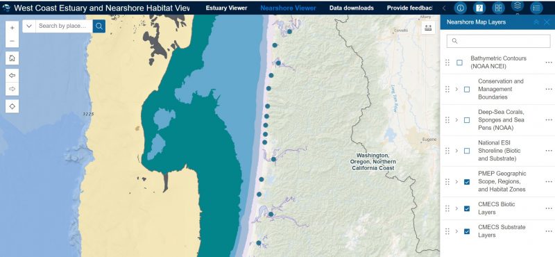
PMEP’s new West Coast Estuary and Nearshore Habitat Viewer is available now. Launched at the recent American Fisheries Society meeting, this new interactive tool combines our estuary datasets with our new nearshore habitat datasets into one easy-to-use platform. The Viewer supports users importing their own spatial data as well as data readily available at ArcGIS Online. Combine these with the PMEP data layers to compare, overlay, and synthesize information to support resource management, habitat conservation and restoration goal setting. PMEP data layers are also available for download. Find the Viewer and PMEP data HERE.
PMEP Launches New Data Viewer
- September 23, 2024
- Joan Drinkwin
- Announcement, Data and Assessments
- 0 comments